- Game
- Grand Theft Auto VI (PS5, Xbox Series X|S), out November 19, 2026
- Map
- The state of Leonida, including Vice City
- Official size
- Not published by Rockstar
- Our measurement
- About 7.5 × 10 miles of land; framed map about 8.9 × 12.4 miles (approximate, from the scale printed on Rockstar's map)
- Scale used
- Rockstar's legend: 1 inch = 0.5 mile; 294 pixels per mile on the 2805 × 3840 download (measured November 20, 2026)
- Counties
- Lummox, Kelly, Leonard, Vice-Dale and Mariana
- Source
- Rockstar Games' Leonida Map and Cover Art Poster (rockstargames.com/VI/media); Edge magazine via Insider Gaming for the GTA 5 comparison
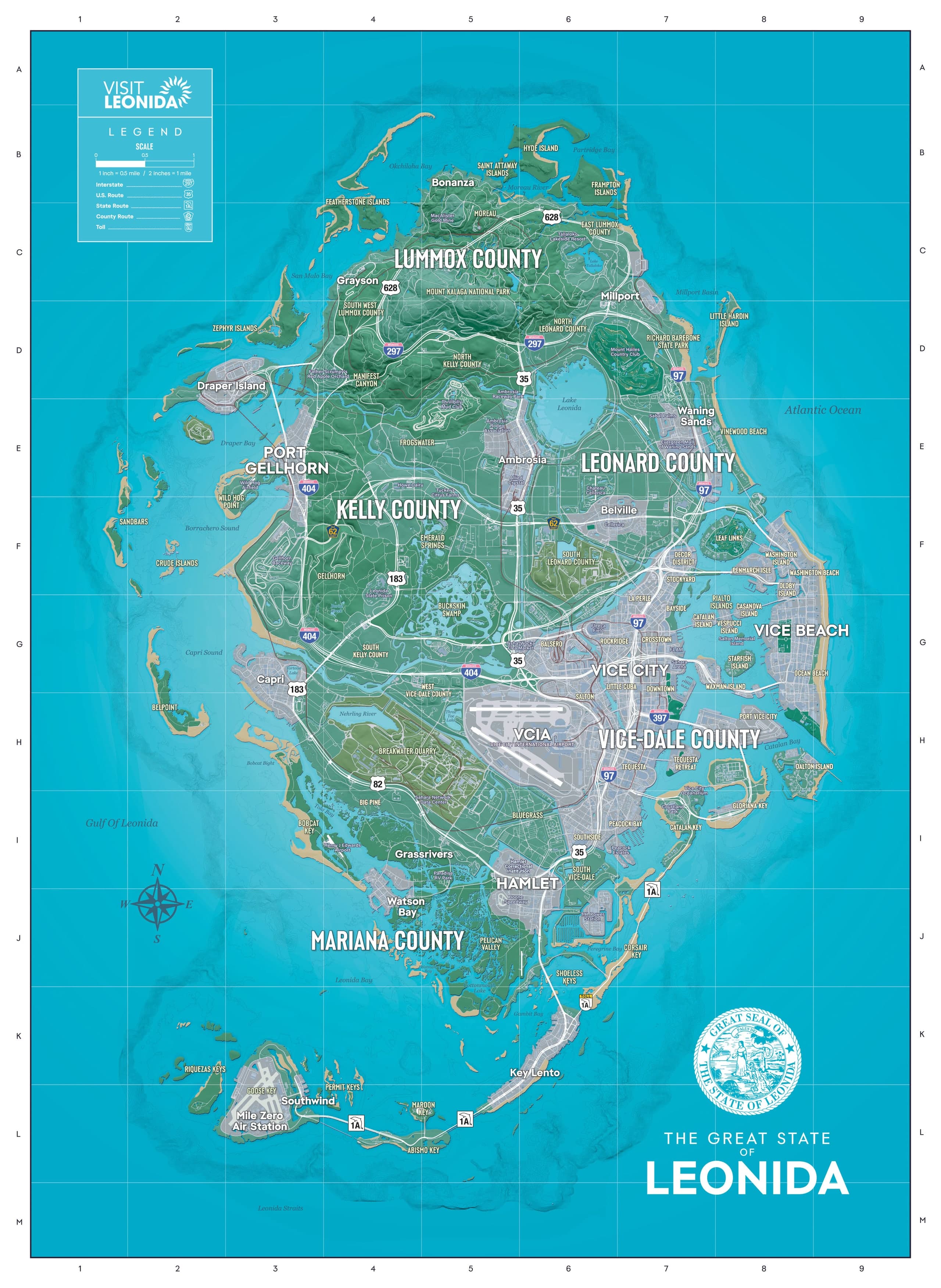
Rockstar printed a scale on its own map. The legend of the "Visit Leonida" poster it released on launch day reads "1 inch = 0.5 mile / 2 inches = 1 mile," with a bar marked 0, 0.5 and 1 mile, and that bar is what our numbers come from.
How big is the GTA 6 map?
Roughly 7.5 by 10 miles of land, about 12 by 16 km. That's what the scale bar on Rockstar's official map of Leonida gives for Grand Theft Auto VI: about 7.5 miles from the westernmost islands to the beach at Vice Beach, and about 10 miles from the northern tip of the mainland down to the southern Keys (about 10.5 if you count the small islands off the north coast). The full map inside its frame, sea included, works out at about 8.9 by 12.4 miles.
| Measurement (our own, approximate) | Pixels on the map file | Miles | Kilometres |
|---|---|---|---|
| Land, west to east (western islands to Vice Beach) | about 2,200 | about 7.5 | about 12 |
| Land, north to south (mainland tip to the southern Keys) | about 2,950 | about 10 | about 16 |
| Framed map, width | 2,621 | 8.9 | 14.3 |
| Framed map, height | 3,657 | 12.4 | 20 |
| Land area (pixel count) | 2.6 to 2.8 million | 30 to 33 sq mi | 78 to 84 km² |
None of this is a Rockstar figure. It's a measurement of Rockstar's printed scale, so it's only as exact as that scale and our pixel edges, and it says nothing about how long a drive takes in the game.
How we measured the GTA 6 map size
We used the full-size file of Rockstar's "Leonida Map and Cover Art Poster" from the GTA VI media page, which is 2805 by 3840 pixels. On that file, the white half of the legend's scale bar, 0 to 0.5 mile, is 147 pixels long, so one mile is 294 pixels. We then measured the map's frame and the outermost land on each side and divided by 294. For the land area, we counted the pixels that aren't sea, lake or river blue and divided by 294 squared. That gives 30 to 33 square miles depending on whether the white roads and labels printed over the land are counted, so treat it as the roughest number here.
GTA 6 map size vs GTA 5 and RDR2
Roughly twice the size, by Rockstar's own comparison. Rockstar told Edge magazine that the GTA 6 map is about twice as big as GTA 5's and that its landmass is nearly as large as the playable areas of GTA 4, GTA 5 and Red Dead Redemption 2 (RDR2) combined, as Insider Gaming reported on October 29, 2026.
There's no official number to put next to ours, though. Rockstar never gave an official size for GTA 5's map, so every square-mile or square-kilometre figure you see for Los Santos and Blaine County is a fan or outlet estimate, and so is any "times bigger" ratio built on one. The two comparisons above come from Rockstar itself; the square-mile figures don't.
What counties are on the GTA 6 map?
Five: Lummox County, Kelly County, Leonard County, Vice-Dale County and Mariana County. Rockstar's map prints the county names in big letters but its legend doesn't mark county borders, so the towns below are the ones printed around each county label.
| County | Where | Towns and places printed nearby |
|---|---|---|
| Lummox County | The north | Bonanza, Grayson, Mount Kalaga National Park |
| Kelly County | The west and centre | Port Gellhorn, Frogwater, Emerald Springs, Buckskin Swamp |
| Leonard County | The northeast, around Lake Leonida | Millport, Belville, Waning Sands, Lake Leonida |
| Vice-Dale County | The southeast | Vice City, Vice Beach, Vice City International Airport, Tequesta |
| Mariana County | The southwest | Grassrivers, Watson Bay, Pelican Valley |
South of the mainland, the Keys run west from Key Lento to Southwind and the Mile Zero Air Station, with no county name printed beside them. Every one of these places is a pin on our interactive GTA 6 map, which uses Rockstar's map as its base.
What are the main towns in Leonida?
Vice City is the big one, with Vice Beach across the bay and neighbourhoods such as Little Cuba, Downtown, Stockyard and Southside printed around it. Outside the city, the map's largest town labels are Port Gellhorn and Capri on the west coast, Ambrosia in the middle of the state between the Kelly and Leonard county labels, Millport and Belville in the east, Hamlet south of the airport and Key Lento in the Keys.
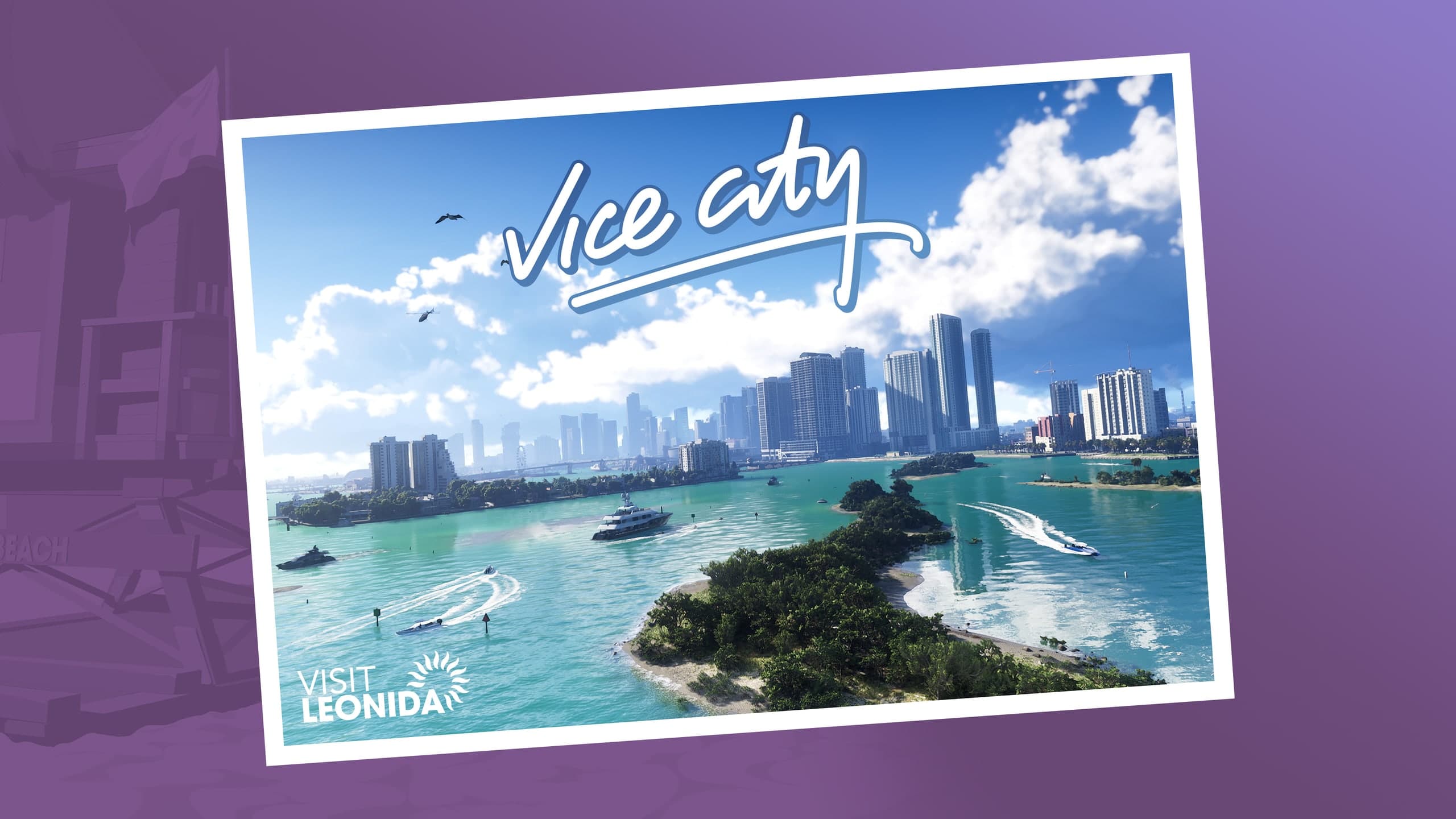
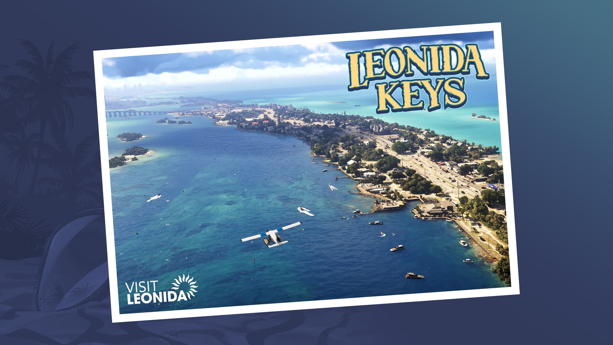
Rockstar's Only in Leonida section splits the state into six areas instead of counties: Vice City, the Leonida Keys, Grassrivers, Port Gellhorn, Ambrosia and Mount Kalaga. The same section is where Rockstar introduces Jason and Lucia and the rest of the cast.
Where can you get the official GTA 6 map?
On Rockstar's site, for free. Rockstar added the printable map of Leonida and the cover art poster to the GTA VI media page on launch day, as its launch-day Newswire post says, under Artwork as "Leonida Map & Cover Art Poster." A double-sided printed version is coming to the Rockstar Store shortly after launch, for $0.99 on its own or free with any Rockstar Store purchase, per Rockstar's November 3 pre-load post.
If you searched "map size" meaning gigabytes: the whole game needs up to 212 GB depending on the console, per that same Rockstar post, and our GTA 6 download size guide has the exact Xbox file.
What we don't know yet
- An official size from Rockstar, in square miles or kilometres, for GTA 6 or GTA 5.
- Whether the poster's printed scale matches the game world exactly. We've assumed it does.
- How long it takes to drive across Leonida. Rockstar hasn't said, and our measurement can't tell you.
Questions and answers
How big is the GTA 6 map in km and km2?
About 12 km across and 16 km from north to south, with roughly 78 to 84 km2 of land, by our measurement of Rockstar's official map. The framed map, sea included, is about 14 by 20 km.
How big is the GTA 6 map in miles?
About 7.5 miles wide and 10 miles long, with roughly 30 square miles of land. These are our approximate measurements from the scale printed on Rockstar's map.
Is the GTA 6 map bigger than GTA 5?
Yes. Rockstar told Edge magazine it's roughly twice the size of GTA 5's map, as Insider Gaming reported.
Has the GTA 6 map size been confirmed?
Not as a number. Rockstar has only compared it with older maps; it has never published a square-mile figure for GTA 6 or GTA 5.
How many counties are in GTA 6?
Five, per Rockstar's map: Lummox, Kelly, Leonard, Vice-Dale and Mariana.